

Application received
27 April 2018
Registration date
5 December 2018
Registered Aboriginal Party boundaries
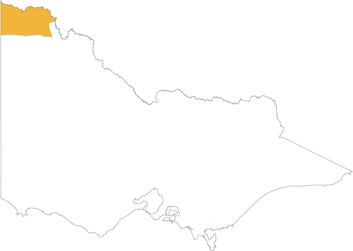
The First People of the Millewa-Mallee Aboriginal Corporation (FPMMAC) are the Traditional Owners of Country in the north west of Victoria that runs south of the Murray River to the Mallee Highway, and west from the Calder Highway to the South Australian border, including the Murray-Sunset National Park.
Download a map showing the boundaries for the First People of the Millewa-Mallee Aboriginal Corporation:
You can also view an online map(opens in a new window) showing all Registered Aboriginal Party boundaries in Victoria. The map works best in Chrome.
Once the online map is displayed:
- Click the Layers icon on the toolbar above the map.
- Select the Appointed RAPs checkbox.
RAP Manager
Norman Wilson
Email: norman.wilson@fpmmac.com.au
Phone: 03 4014 9780
Post: First People of the Millewa-Mallee Aboriginal Corporation, c/o PO Box 10382, Mildura Vic 3500
Website: fpmmac.com.au
Council's decisions about First People of the Millewa-Mallee Aboriginal Corporation
Updated