

Application received
- 18 July 2007
Council decisions about Dja Dja Wurrung Clans Aboriginal Corporation
- Appointed for part of its application area on 19 September 2008
- Area extended on 1 November 2012
- Area extended on 7 February 2013
Registered Aboriginal Party boundaries
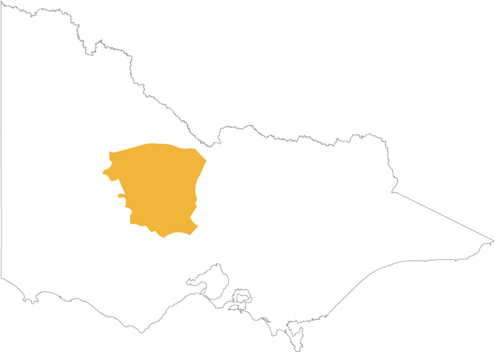
Download a map showing the boundaries for the Dja Dja Wurrung Clans Aboriginal Corporation:
Dja-Dja-Wurrung-Clans-Aboriginal-Corporation
(opens in a new window)
You can also view an online map(opens in a new window) showing all Registered Aboriginal Party boundaries in Victoria. The map works best in Chrome.
Once the online map is displayed:
- Click the Layers icon on the toolbar above the map
- Select the Appointed RAPs checkbox
Contact
Cassandra Lewis, A/Chief Executive Officer
Post: PO Box 1026, Bendigo Victoria 3552
Email: ceo@djadjawurrung.com.au
Website: www.djadjawurrung.com.au(opens in a new window)
Phone: 03 5444 2888
Fax: 03 5441 6472
Council decisions about Dja Dja Wurrung Clans Aboriginal Corporation
2008 DDWAC appointed as a RAP
(opens in a new window)
DDWAC decision 2012 with map
(opens in a new window)
DDWAC 2012 decision in detail
(opens in a new window)
DDWAC decision 2013 with map
(opens in a new window)
DDWAC 2013 decision in detail
(opens in a new window)
Updated