

Application received
25 July 2011
Council decisions
- Further application received 15 August 2014
- Eastern Maar appointed for part of its application area on 5 December 2013
- Application declined on 11 October 2018, in relation to a variation of the RAP boundary area
- Request approved on 6 February 2020, in relation to a variation of the RAP boundary area
Registered Aboriginal Party boundaries
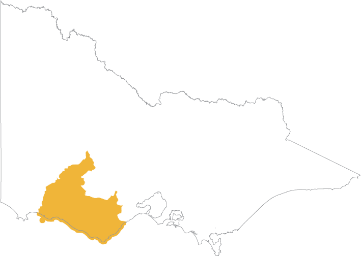
Download a map showing the boundaries for the Eastern Maar Aboriginal Corporation:
Eastern Maar Registered Aboriginal Party Boundary Map
(opens in a new window)
You can also view an online map(opens in a new window) showing all Registered Aboriginal Party boundaries in Victoria. The map works best in Chrome.
Once the online map is displayed:
- Click the Layers icon on the toolbar above the map
- Select the Appointed RAPs checkbox
Contact
Post: PO Box 546, Warrnambool Victoria 3280
Email: admin@easternmaar.com.au
Phone: 0427 271 937
Website: www.easternmaar.com.au(opens in a new window)
Council decisions about Eastern Maar Aboriginal Corporation
EMAC RAP appointment DEC 2013
(opens in a new window)
EMAC RAP boundary variation FEB 2020
(opens in a new window)
Updated